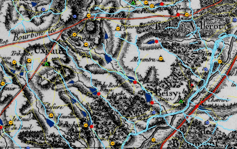
1759 Cassini map, with digitized GIS data showing mills, ponds and streams
Our project uses a variety of integrated methods and techniques. Our primary activities fall into the following groups:
1759 Cassini map, with digitized GIS data showing mills, ponds and streams
© 2024 The Burgundy Historical Landscapes Working Group
Theme by Anders Noren — Up ↑