© 2024 The Burgundy Historical Landscapes Working Group
Theme by Anders Noren — Up ↑
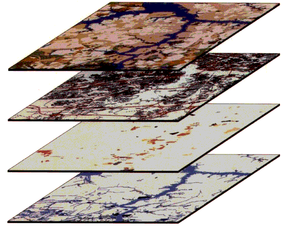 One of the powerful toolkits that we use is Geomatics: the integrated analysis of spatial data using a variety of interconnected, digital approaches that includes Geographic Information Systems (GIS), Global Positioning Systems (GPS), historical aerial photography, historical cartography, and satellite remote sensing. All of these together allow us to access, store, analyze, and display spatial data.
 © 2024 The Burgundy Historical Landscapes Working Group
Theme by Anders Noren — Up ↑